JURNAL / ARTIKEL
It appears you don't have Adobe Reader or PDF support in this web browser. Click here to download the PDF
-
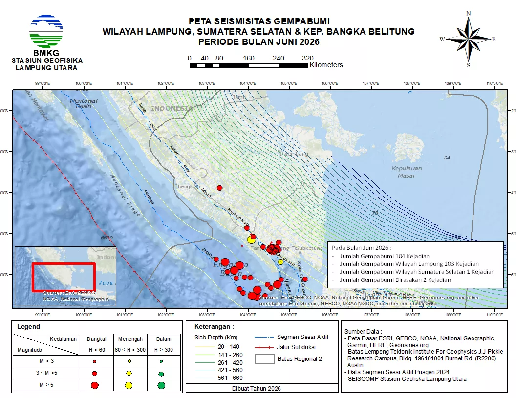 Aktifitas Gempabumi Wilayah Lampung, Sumatera Selatan dan Kepulauan Bangka Belitung Bulan Juni 2026
06 Jul 2026
Aktifitas Gempabumi Wilayah Lampung, Sumatera Selatan dan Kepulauan Bangka Belitung Bulan Juni 2026
06 Jul 2026
-
 Informasi Seismisitas Gempabumi WIlayah Lampung, Sumatera Selatan & Kepulauan Babel Periode Bulan Mei 2026
03 Jun 2026
Informasi Seismisitas Gempabumi WIlayah Lampung, Sumatera Selatan & Kepulauan Babel Periode Bulan Mei 2026
03 Jun 2026
-
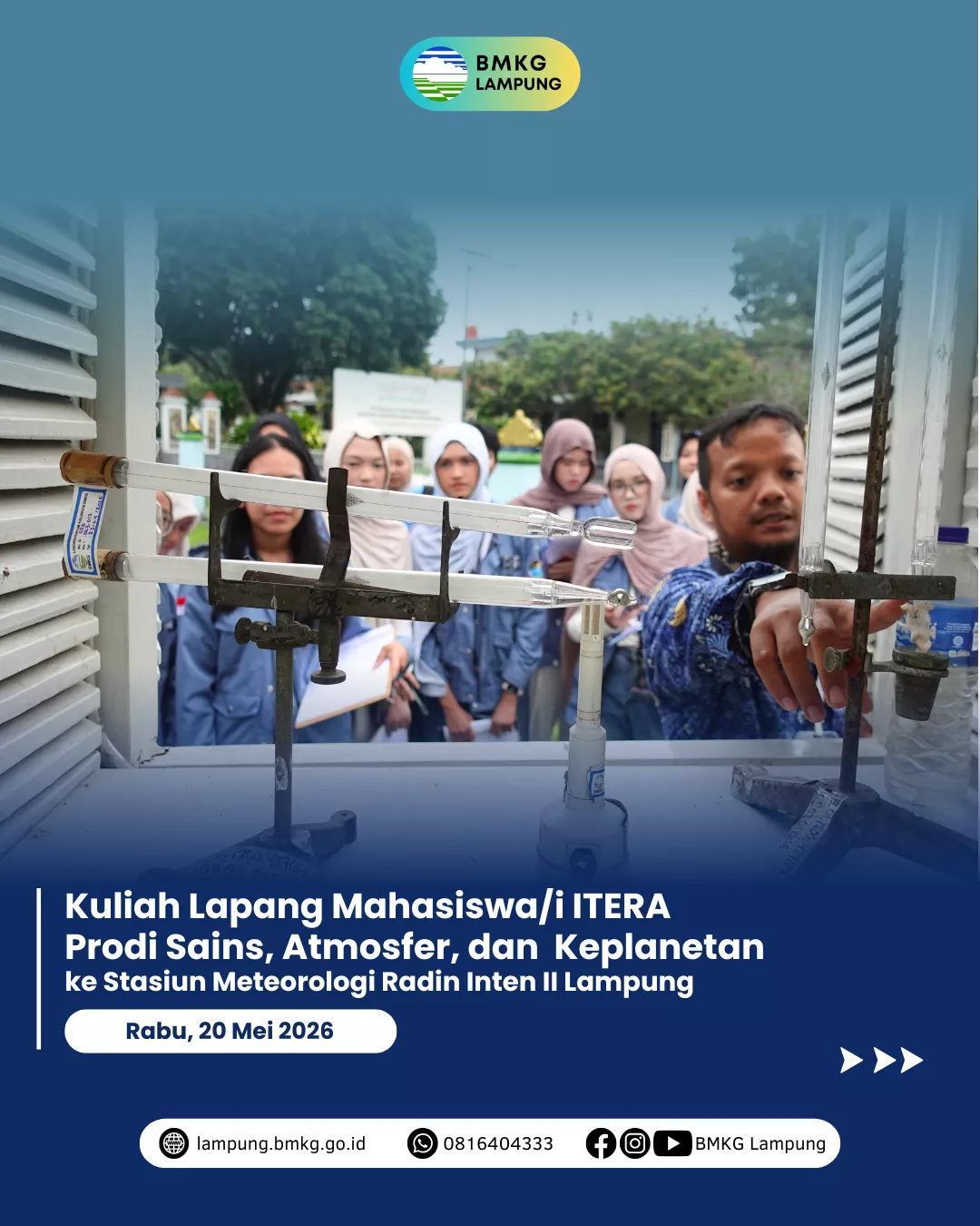 Kuliah Lapang Mahasiswa ITERA Prodi Sains, Atmosfer, dan Keplanetan ke Stasiun Meteorologi Radin Inten II Lampung
23 May 2026
Kuliah Lapang Mahasiswa ITERA Prodi Sains, Atmosfer, dan Keplanetan ke Stasiun Meteorologi Radin Inten II Lampung
23 May 2026
-
 Sebaran Gempabumi Wilayah Lampung, Sumatera Selatan dan Kepulauan Bangka Belitung Bulan April 2026
04 May 2026
Sebaran Gempabumi Wilayah Lampung, Sumatera Selatan dan Kepulauan Bangka Belitung Bulan April 2026
04 May 2026
-
 Kunjungan SMA Muhammadiyah Ahmad Dahlan Metro ke Stasiun Meteorologi Radin Inten II Lampung
03 May 2026
Kunjungan SMA Muhammadiyah Ahmad Dahlan Metro ke Stasiun Meteorologi Radin Inten II Lampung
03 May 2026
- PENGEMBANGAN SISTEM PELAYANAN TERPADU SATU PINTU BERBASIS WEB MENGGUNAKAN METODE SCRUM PADA STASIUN METEOROLOGI KELAS I RADIN INTEN II 08 Jun 2026
- Comparative robustness and interpretability analysis of MLP and random forest for multi-class weather classification in tropical regions 21 May 2026
- Evaluating BMKG Public Information Services in Flood Disaster Areas Using ITO (Input-Throughput-Output) Model Approach 21 May 2026
- Climate Change Impact On Rice Productivity Using FAO AquaCrop Model: A Case Study in Lampung 21 May 2026
- Utilization of Satellite Imagery and GIS for Mapping Potential Anchovy Fishing Areas in East Lampung 05 May 2026